Versão portuguesa aqui.
GPS 38.41266836239934, -28.030617428067632
This lighthouse first appeared in the General Plan, approved in 1883, providing for the installation of a 2nd order device, producing a flash of white light.
Councilor José de Ávila also agreed with its establishment in his report prepared in 1891.
The 1902 commission differed from this proposal and proposed: “the commission proposes the installation at Ponta da Ilha of a 3rd order apparatus, small model, showing 4 white flashes every 10 seconds”.

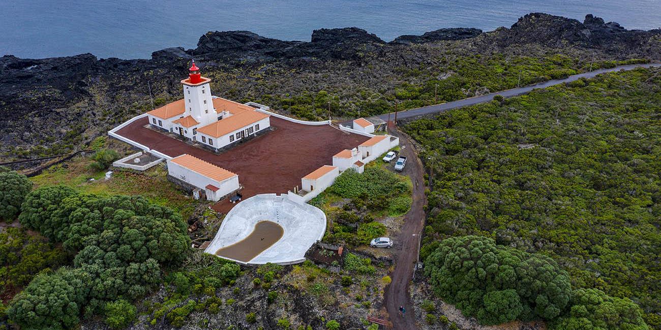
However, it was only in 1942 that the projected lighthouse began to materialize, with the purchase of a thousand square meters of land, for the price of 200$00.
The budget for the construction of the building, prepared that same year, was 231,632$81.
The contractor for the work was Manuel Nunes Rosa.
The Ponta da Ilha lighthouse came into operation on July 21, 1946. It has a tower 19 meters high and 29 meters high. Initially it was equipped with a 5th order apparatus (187.5 mm focal length), which had been removed from the Serreta lighthouse; the light source was incandescence by oil vapor and had a constant level lamp as a reserve.
In 1957 a house for the engines was built for the sum of 60,400$00.
The lighthouse was electrified in 1958 through the assembly of generating sets, with the light source becoming a 3000 W electric incandescent lamp.
In 1959 the lighthouse was connected by road to the village.
Due to the poor condition it was in, the optic was replaced in 1960 by another of the same model that had been removed from the Amêijoa lighthouse.
In 1987, the optical apparatus was again replaced by more modern equipment with sealed optics, mounted on a rotating pedestal with power reserve and incorporated light source (PRB-46 system).
The lighthouse was electrified with power from the public grid in 1993.
On March 31, 2006, the PRB – 46 system was replaced by the BGA – 600 ODA 200. This system was later replaced, on August 20, 2022, by the TRB 400 system.

LOCATION: On the east end of the island
FUNCTION: Coastal
ESTABLISHMENT: 1946
LATITUDE: 38º 24.76 N - 38º 24.75' N (WGS)
LONGITUDE: 28º 01.90 W - 28º 01.84' W (WGS)
HEIGHT: 19 meters
ALTITUDE: 29 meters
RANGE: 20 Miles (37KM)
FEATURE: FL(2) W 20s Lt 0.16; Ec 6.5 / Lt 0.16; EC 13.18
TRB 400 OPTIC